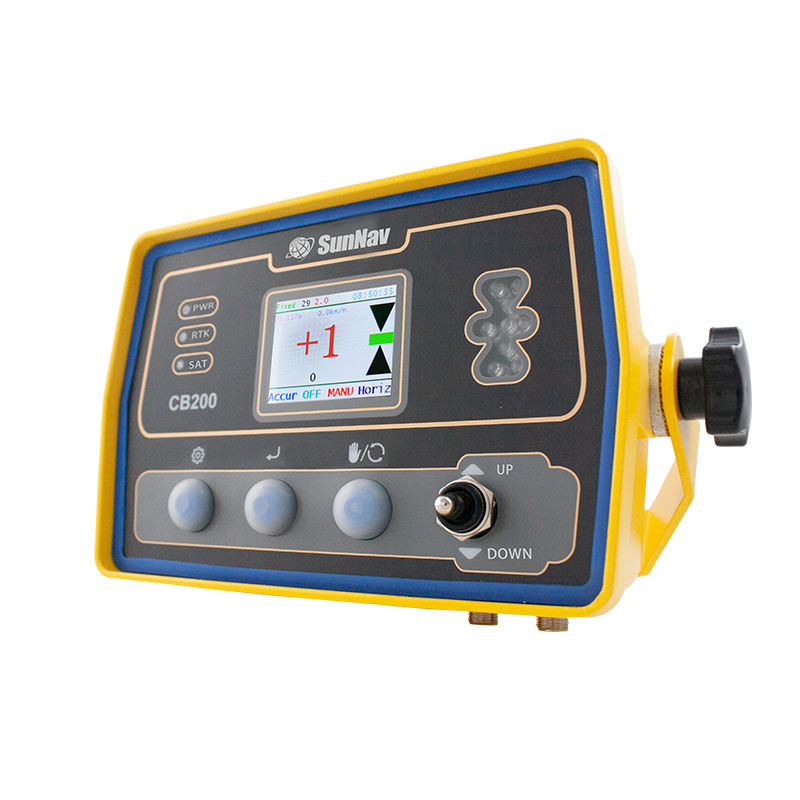
AG200 GPS Land Leveling System

Description

AG200 GPS Land Leveling

Powerful & Aff rdable

AG200 GPS Land Leveling System

The AG200 system is a high-precision and high-performance GNSS Land Leveling system, independently developed by SunNav. Widely used in precision agriculture for wasteland restoration, land remediation and leveling, slope land conversion, paddy field leveling, dry land leveling and other large areas land leveling. It can also be used for water conservancy, airport construction and large-scale stadium construction.
■ Manual/AUTO Leveling Function;
■ One Set For Benchmark;
■ CORS System;
■ Support Slope Function;
■ Long Working Range(3-5KM, 15-20KM(Opation);
■ Easy Installation and Maintenance;
■ High Precision Positioning System(BEIDOU GPS GLONASS GALIEO);
■ Could Work In Harsh Environment;
■ 4G Network(for option).

Parts

Satellite Antenna

Remote Controller

GNSS Controller
CB-200

Cable

Radio Antenna

System Configuration

AG700 is very simple to set up, and the base station effectively transmits a radius of 10km under the external station.

Complete

Strong compatibility, AG700 can be used in most tractors.

Application Field

It could be widely used for precision agriculture field : waste land reclamation, land leveling, slopping land to terrace, water land leveling , as well as large area hydraulic engineering , air portcon struction and sports ground construction.

PRECISION AGRICULTURE

waste land reclamation, land leveling, slopping land to terrace, water land leveling

HYDRAULIC ENGINEERING

It can be used for dam construction, river leveling, slope control.

AIR PORTCON STRUCTION

It can be used to build airfields and airstrips to level the foundation.

SPORTS GROUND CONSTRUCTION

It can be used for foundation leveling of football and sports fields.

CONTACT US

Welcome to establish communication with us!

OUR OFFICE

SunNav Technology Co.,Ltd.

Add:Floor 4,Door 1,No.9 Haitai Huake 3rd Road Huayuan Industrial District Binhai High-tech Zone Tianjin,China

Fax:+86-22-87938615

Telephone: +86 18920490670

Email:[email protected]


CONTACT US

Additional information

SINGNAL TRACKING

352Channels
-GPS: L1/L2
-BDS: B1/B2
-GLONASS:L1/L2
-SBAS:L1C/A
Galileo(upgradable)
BDS global signal (upgradable)

POSITIONING SPECIFICATIONS

PostProcessing Static:Horizontal:2.5mm+1ppm, Vertical:5.0mm+1ppm
RealTime Kinematics (RTK):Horizontal:10mm+1ppm, Vertical:20mm+1ppm
SBAS:1.0m
Initializationtime: < 10s
Initializationreliability: > 99.9%
Up to 20Hz raw measurement & position outputs
Timeto First Fix
Cold start <50s
Hot start < 15s
Signal re-acquisition <3s

PHYSICAL AND ELECTRICAL CHARACTERISTICS

Size:213mm x 119mm x 73mm
Weight:1.2kg
Temperature Operating:-40℃~70℃
TemperatureStorage:-45℃~80℃
Humidity:95% condensation
Power:12v
Communication interface: 2RS232 interfaces /2external power interface (lemo)
Radio frequency interface:1 UHF antenna interface / 1 GNSS antennainterface

REFEERENCE OUTPUTS/INPUTS

RTCM2.X/RTCM3.0/RTCM3.2、 MSM4、MSM5

COMMUNICATION PROTOCOL

TRANSEOT/TRIMTALK

INSTRUCTIONS

3 LED indicator lights (power light/star search light/datatransmission light)
High definition LED screen
Frequency/protocol/baud rate adjustable